Day 4
Start/end/time 7:50 – 2:35 6:45
Distance/ascent/pace 8.1 +647/-495 1.2 mph
 Day 4 was the shortest mileage wise but took us the longest to complete. The trail was unbroken and had 8” to 10” of new snow from the storm the day before. Air temp near 0 degrees. We got going fairly early anticipating a long day.
 The first section was relatively flat but the drifts and hommocks were a pain. Too steep for wax, and the trail too narrow to herring bone. At Wassataquoik Stream the sky showed signs of clearing. We crossed at the normal summer crossing it looked solid. Jim was our probe and seemed to have no issues… I started to follow and about half way across, Jim says “Wait, I need to get a picture” and so I start to shuffle backwards for a pose. Suddenly, I realize my tracks are wet. I wasn’t worried about breaking thru, but icing my skis. As quick as I could I make for dry snow and higher ground – too late. Ice had already built up on my skis. Had to take them off and scrape the crust.


reason I was able to make progress was due to brut force poling.
Eventually we get to the final section – traveling cross slope thru mostly open hardwoods, in and out of 20’ deep gullies every 200 to 300 yards. There were literally dozens of streams draining down from Turner Mt to our East. Each leaving another gully to clamber through. I took my skis off 3 times to navigate the gullies - they were that tough - skins and BC skis would have helped a lot.


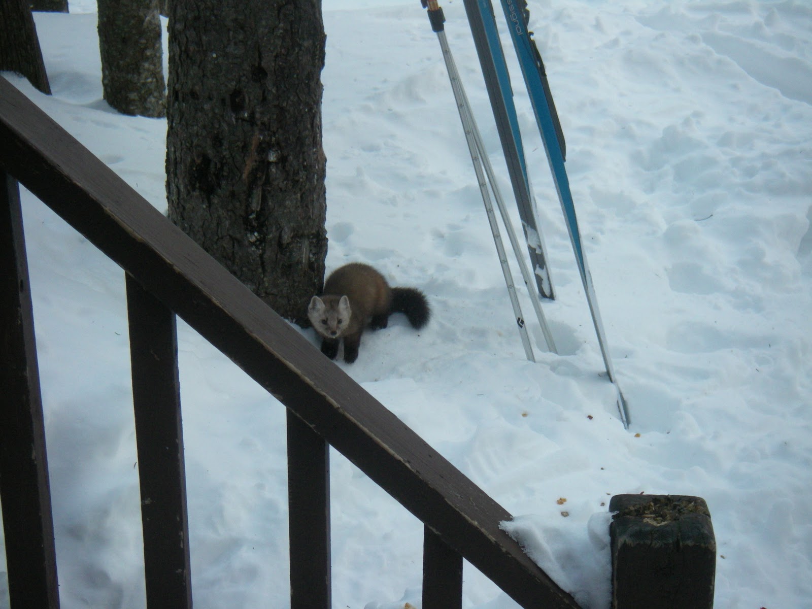
The cabin was empty on arrival and the ranger said no others would be coming in. Nice! Plenty of space for all our gear to dry. Outside a Pine Martin was scavenging something near the porch. Was fun to watch him….

Part III Heading for home….
Day 5
Start/end/time 7:15 – 11:05 3:50
Distance/ascent/pace 12.9 +455/-1337 3.4 mph
All were up early and eager to go. Conditions were excellent and looked like a good day. A sign in the cabin explained it was a 10 hour day to get to Abol Bridge from Roaring Brook. Took us less than 4 hours. Because of the groomed road, good snow, and my skinny skiis. Jim and Bart pulled the rear all day. Breaking trail or going uphill they would leave me in the dust, but on a trail like this, they didn’t have a chance against my long skinny skis.

Out standing trip. I would do it again. The big thing is – as always – conditions. The following weekend there was rain, several inches then snow, like 18”!! Had we gone that weekend it would have been unbelievably miserable. We were lucky.

1 comment:
Hey nice recap! Love the elevation profiles you add. Sounds like an awesome trip!
Post a Comment